Wednesday, November 28, 2012
November 15-18, 2012 -- Fairhope, AL to Ft. Walton, FL
Tuesday, November 20, 2012
November 12-14, 2012 -- Big Briar Creek to Dog River, AL
A 0530 wake up call got us through the Coffeeville Lock before dawn fully broke. This is the last lock on the river system.
This tug along shore was pulling a propeller up on a line near the bow, with divers in the water. We wondered what was up.
This photo of one page of our chart shows why it is 100 miles as the crow flies from Demopolis to Mobile, but 200 miles as the river flows! Shortly we come to the junction of the Alabama and Tombigbee Rivers. From this point on the waterway is called the Mobile River.
We anchored for the night with three other boats in roomy Big Briar Creek, just off the Tensas Cut Off.
There are occasional homes along the river, with rickety docks. And we know we are getting south, as we saw a huge gator slip off the muddy banks as we passed.
Now we are in Mobile.
These stealth military ships are built here by Austal Shipbuilders, a big employer. Airbus’ US headquarters is also in Mobile, bringing lots more jobs.
The 600-foot Star Fraser out of Bergen was crosswise in the river as we approached, making a U-turn with the help of two tugs.
The skyline has a lacy look.
Ships come here for repairs, this one in a dry dock. The dock is submerged, the ship is parked in it; as the water is pumped out of the dry dock it rises up.
Monarch hurried to get ahead of the container ship Yan Ming Mobility, southbound on Mobile Bay. Unfortunately, her considerably large bow and stern wakes caught us broadside as we turned north into the Dog River Channel, rolling us severely. But no damage.
We entered Dog River Marina, located on the western shore of Mobile Bay at low tide.
Here we will spend two nights, to have Monarch pulled out of the water and her spurs installed. These are line cutters that mount in front of the propellers, designed to cut any lines (like from crab traps) that might wind around the shafts.
Sunday, November 18, 2012
November 9-11, 2012 -- Rattlesnake Bend to Bobby's Fish Camp
Exiting the Tom Bevill lock, and further south, Monarch passes the white chalk cliffs at Epes, Alabama, which purportedly rival the White Cliffs of Dover. Shortly after the cliffs, we revisited the good anchorage we found three years ago, as we took a left turn into Rattlesnake Bend. Actually this is the Tombigbee River’s giant oxbow; the Army Corps of Engineers made a bypass that shortened the kink. We anchored for the night next to new friends on Jackets II, Stephen and Charlotte. We plan to be at anchor or a dock by 4:30 p.m. nowadays, because we lose our daylight shortly after that. No sane mariner would be navigating the river after dark (except the tugs, who are fearless and indestructible!).
The morning fog was lifting as we pulled anchor the next morning, here go our 'new friends' Stephen and Charlotte on Jackets II. A short way down stream the waterway becomes the Black Warrior-Tombigbee Waterway – and passes the town of Demopolis, Alabama.
Here we found a secure tie up at the new Kingfisher Bay Marina, next-door to Demopolis Yacht Basin where we docked in 2009. Located at the confluence of the Tombigbee and Black Warrior Rivers, this small town is committed to historic preservation.
A highlight is Bluff Hall, a beautifully preserved 1832 antebellum house, listed on the National Register of Historic Places and now a museum with many of its original furnishings. Period clothing hangs in the Victorian armoires, portraits of the owners grace the walls and a local history display provides commentary. Now the museum gift shop, the original kitchen for Bluff Hall was a separate building, to keep fire danger away from the main house
Larger and even more impressive are the mansion and grounds of nearby Gaineswood National Historic Landmark, billed as the state’s most unique antebellum mansion, featuring domed ceilings, ornate plasterwork, columned and galleried rooms, original furnishings, and ghost stories. Considered one of America's finest examples of Greek Revival architecture, Gaineswood was built between 1843 and 1861 by Nathan Bryan Whitfield, who named the mansion Gaineswood in honor of city father George Strother Gaines. Visitors can tour the mansion which contains many original Whitfield family furnishings donated by descendants – but not today, as it was closed.
The Demopolis Yacht Basin, next door to Kingfisher Bay and part of the same marina, features a huge pecan tree, which we harvested three years ago. Here is this year’s harvest. The Yacht Basin’s on-premises dining establishment, the New Orleans Bar and Grill, features tasty fresh catfish and delicious jambalaya, which we enjoyed that evening.
We were up with the early crew, before 06:00 hours to transit the Demopolis lock, along with four other boats.
After a long run, the only option for the night is Bobby’s Fish Camp, famous because – it’s the only game in the area! The dock is small, and the boats raft off as needed. We had five boats tonight; the record is seventeen! (For the curious and map experts among you, Bobby's can be found at N 31 45.8617 - W 088 09.4756)
The fine dining establishment waits up the hill.
While short on atmosphere, the catfish and companionship of our friends was excellent. A quiet night at the dock topped it off.
Wednesday, November 14, 2012
Nov 4-8, 2012 - Iuka, MS to Tom Bevill Lock and Dam, AL
We remembered to “fall back,” for an extra hour of sleep, with an overnight low of 47, and had a beautiful day for cruising. Here we pass Savannah, Tennessee, and the antebellum mansion where General Grant slept. Savannah is the “Catfish Capital of the World!”
We passed under Pittsburgh Landing, site of the Shiloh National Military Cemetery.
After transiting Pickwick Lock, we anchored in Dry Creek, just off Pickwick Lake. The lake is a wide spot in the Tennessee River, with beautiful shoreline foliage.
After leaving Pickwick Lake, it’s a quick trip of 7 nautical miles to Aqua Yacht Harbor, near Iuka, Mississippi, just a stone’s throw from Tennessee. We stayed for two nights, to change oil in both engines and the generator (43 quarts in all, every time!), and make a trip for supplies in the harbor’s courtesy van. We also stayed to watch the election returns on their cable TV hookup, as the surrounding area has little to no broadcast available. The next morning, we departed early, and joined the Tennessee-Tombigbee (Tenn-Tom) Waterway, which connects the Tennessee and Tombigbee Rivers. Starting at the Mississippi-Tennessee border to the north and running through northeast Mississippi, the Tenn-Tom extends to west-central Alabama.
The waterway is industrial in many places, and convenient not only for pleasure boaters, but for commerce, as witnessed by this pulp operation. Running east of and parallel to the Mississippi River, the Tenn-Tom shortens the southward trip by 144 miles and provides a less-congested river route to the Gulf of Mexico.
The waterway contains ten locks and dams, all prominently marked with red danger signs. The concept for the Tenn-Tom originated as early as 1770, but because of estimated costs, the project wasn’t authorized until two hundred years later, in 1971. After 12 years under construction and costing nearly $2 billion, the waterway was opened for commerce in January 1985. The system is five times longer with 3½ times greater lift than the Panama Canal, making it the largest civil works project ever undertaken by the U.S. Army Corps of Engineers.
Locks on the waterway are 600 by 100 feet, just barely large enough to hold the Mr. David and his raft of barges, here exiting Amory Lock.
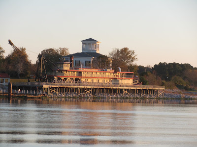
At the Tom Bevill Lock and Dam, we spotted the 1926-vintage U.S. Snagboat Montgomery, the last steam-powered sternwheeler to ply the inland waterways of the south. For nearly six decades, the 108 foot-long Montgomery labored to keep seven of the South’s major rivers navigable by removing “snags” or obstructions in the waterway. Now, she’s a shore-bound museum.
We had come up behind Jackets II, a good-looking Krogen Express 52. This is the first Looper boat we had seen since Chicago. After conversing on the radio, we decided we could both fit in the small harbor next to the lock for the night’s anchorage, and a ready-to-go spot for tomorrow’s crack of dawn locking.
As the sun’s last rays painted the beautiful foliage on the shore, we invited new friends Steven and Charlotte from Jackets II over for cocktails. They are from Jacksonville, Florida.
Sunday, November 11, 2012
November 1 - 3, 2012 -- Cumberland Towhead to Double Island
It’s cool in the mornings, in the low 40s, on our fall trip down the rivers. We were up before the sun to tackle the Cumberland River on our way south.
The Three River’s Quarry is mining gravel at Wilson’s Landing.
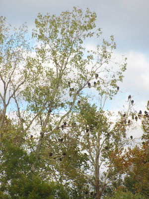
And the same vultures waited patiently in the trees, just as they had when we passed three years ago!
The Barkley Lock is the only lock on the Cumberland River, and she’s a big one, dropping Monarch 57 feet.
The descent is smooth, as there are floating bollards to which we tied two midship spring lines.
Exiting the lock, we turn into Green Turtle Bay Marina for the night. They had courtesy vans, which we took to Wal-Mart in Paducah, Kentucky, about 45 minutes away by car.
The docks here are nice, though deserted. We feel like we are sweeping up at the end of the seasonal parade of Great Loop boats.
After leaving Barkley Lake, we transited the Barkley Canal into Kentucky Lake. The lake is a wide spot in the Tennessee River, formed by the Kentucky Dam. It was a beautiful sunny day, and we stopped for the evening at Paris Landing State Park, in Kentucky.
We explored the park, which overlooks the Tennessee River from a high bluff.
This flock of hundreds of American Coots clustered together looks like an obstruction to navigation. They have distinctive white bills and small black bodies.
The park has decorated for the fall season. A ranger picked us up in a van for the short ride to dinner.
The dining room had a beautiful view, and a fair amount of patrons.
Next morning, we departed the park, and shortly after saw this bizarre sight, a fully camouflaged duck blind, motoring under outboard rowboat power, looking for a good spot to put its spuds down for the season.
The high banks sometimes feature homes….
but more often are wild and barren. This is called Lady Finger Bluff for obvious reasons.
An unexpected warm up saw today’s temperatures in the high 70s, causing an extension of the water-skiing season. For the night we anchored at Double Island, just in time to watch a small but intense thunderstorm hurl bolts of lightening to the shore around us, leaving us safe and unscathed. No more warm weather this week!
Subscribe to:
Comments (Atom)


